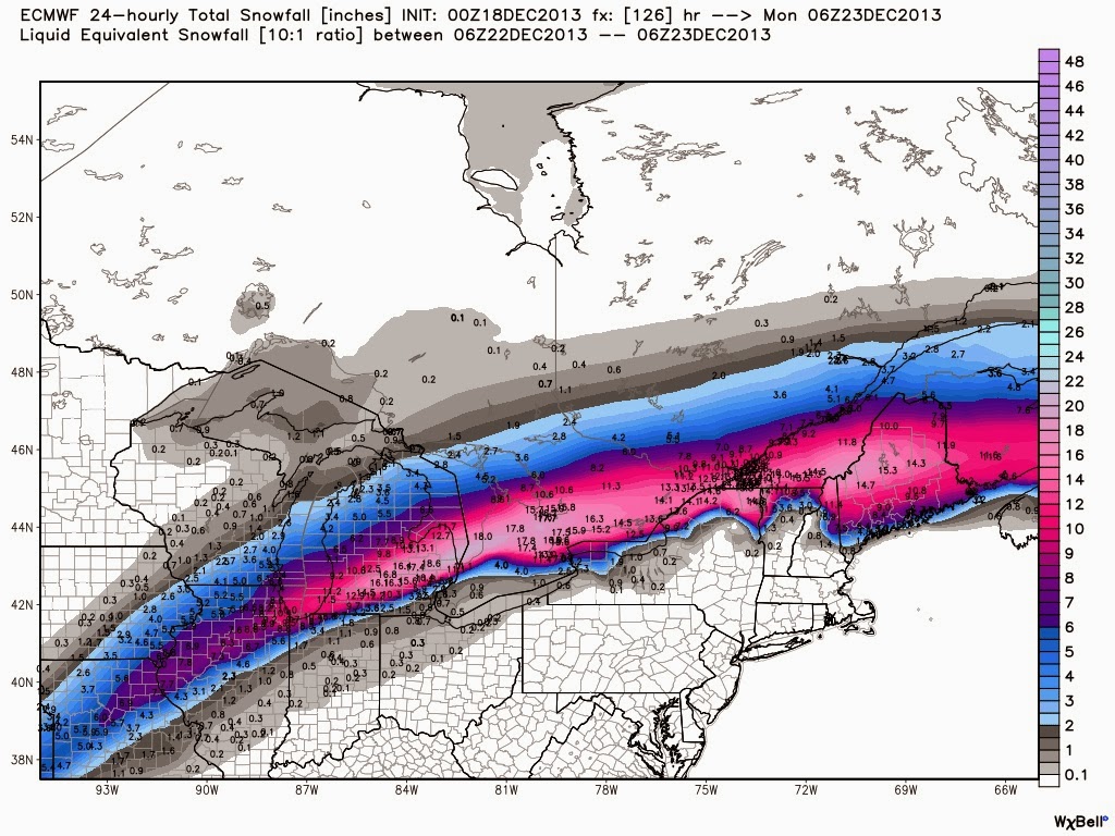
Sunday's storm is still there. There is a spread of solutions in the models, especially with regards to track. The UK and Can tracking the low farther north through Ontario and the JMA well to the south and the GFS and Euro in the middle, just south of the lakes. Right now, I would trust the GFS and Euro track over the others, based on quality of model. However the GFS is splitting/stretching the energy out so that the precip bands are not as intense as the Euro. As such, the Euro is still the most gung-ho storm forecast (see map below, again 24 hour snowfall totals for the period ending Sunday night).
No comments:
Post a Comment