Here are the maps of the Euro and GFS with their respective prediction of total snowfall over the next 72hrs. Algonquin, Appalachians and New England/New Brunswick are getting hit. Like I wrote the other day, don't be surprised if we get a coating over night tonight.
Friday, October 31, 2014
Wednesday, October 29, 2014
Not as bad as it could have been...
The trough coming in is stronger the predicted earlier. Hence much of the energy is going south of us. So the Eastern Ontario area will get a mix of shower and flurries. Grassy areas may be white Saturday morning in the Ottawa area..
Look for a significant Lake Effect snow event in the typical snow belt regions on the back side of this storm...
Look for a significant Lake Effect snow event in the typical snow belt regions on the back side of this storm...
Sunday, October 26, 2014
Still there....
GFS for Friday evening:
Euro (showing 24hr snowfall from Friday aft to Saturday aft)
Canadian shows nothing.
Euro (showing 24hr snowfall from Friday aft to Saturday aft)
Canadian shows nothing.
Saturday, October 25, 2014
A scary Halloween??
Two of the more reliable models are still calling for some downright messy weather late next week as the remnants of Pacific hurricane Ana pass through. The GFS is showing us cold but scattered flurries at this point. The Euro is definitely messier of the two, with several cms of snow predicted by to on Friday and again on Monday.
Snow or no, definitely looking like a cold end of the week into the weekend.
Snow or no, definitely looking like a cold end of the week into the weekend.
Thursday, October 23, 2014
Thursday, October 16, 2014
Recent warm weather...
Before anybody starts claiming climate change, here are the record highs:
Oct. 13: 26.3C in 1995 (2014: 17.1C)
Oct. 14: 24.4C in 1956 (2014: 26.0C, a new record)
Oct. 15: 25.6C in 1956 (2014: 23.5C)
Oct. 16: 26.7C in 1947 (!) (I doubt we are getting anywhere close to that high today)
Oct. 17: 26.7C in 1947(another one!)
Oct. 18: 26.1C in 1947
Apparently October 1956 and 1947 were warm ones in Ottawa...
Wednesday, October 15, 2014
Hurricane Hazel...
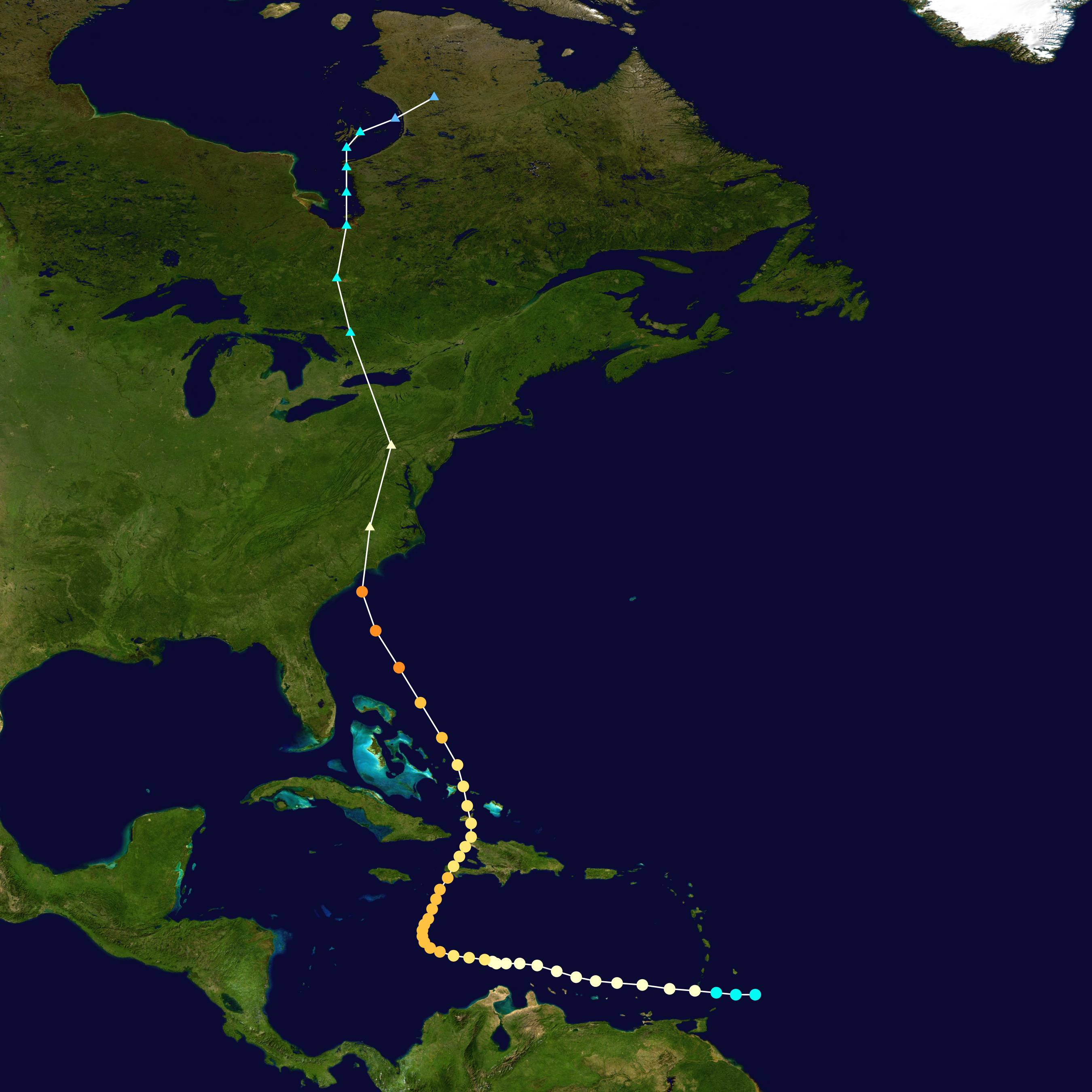
As Gonzalo is now a Cat3 hurricane and will likely impact Bermuda as such on Friday, it is good to remember historical hurricanes. Today is the anniversary of the landfall of Hurricane Hazel in 1954 as a Cat4, an unprecedented and as yet unrepeated event for Southern Ontario as it maintained much of its strength coming northward causing vast amounts of damage.
Sunday, October 12, 2014
Wednesday, October 8, 2014
Flakes in the air
There is a chance that, if there is precipitation first thing Thursday morning, it may be of the frozen kind. Temperatures 5000ft up will be cold enough for snow but nothing will stick as surface temps will still be a few degrees above 0.
Subscribe to:
Comments (Atom)


